 HOME
HOME




The battle against wildland fires is benefiting from the incorporation of artificial intelligence as technologies change both on the ground and in the air. Nick Veronico explores the new technologies in the USA and its potential application to firefighting.
On the ground, new sensor technologies are being developed that will help get resources to hot spots sooner, giving fire fighters the opportunity to control a blaze before it gets out of control. Drones and full-scale, pilotless, rotary-wing air attack aircraft are fast becoming a reality, which will one day enable around-the-clock aerial fire suppression. These technologies are not pipe dreams, they are driven by big name corporations, technology innovators, and government agencies all teaming to reduce wildfire risks.
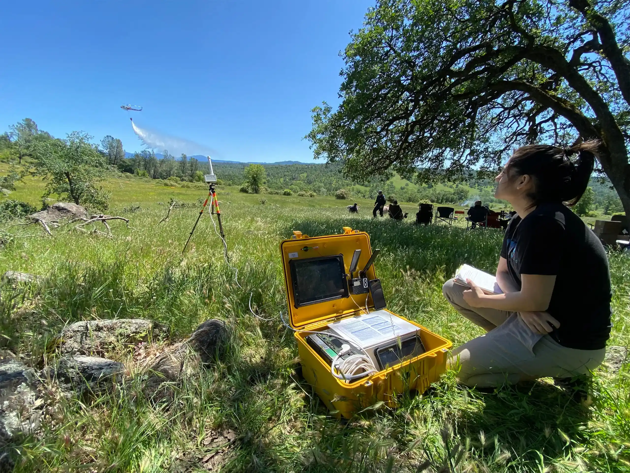
In California’s Silicon Valley, scientists at NASA Ames Research Center are expanding the ability for on-site fire commanders to use drones to detect and surveil wildland fires. Drones, or Uncrewed Aircraft Systems (UAS), have traditionally been kept out of airspace over a fire while crewed air attack aircraft are operating due to safety concerns. The potential for a mid-air collision is too great when an air attack crew is flying, focused on their drop, and unable to see or detect as small drone in hazy skies.
NASA’s Advanced Capabilities for Emergency Response Operations (ACERO) is enabling crewed aircraft, drone operators, and ground crews to
share information during wildland fire operations through a new suite of airspace management technologies. ACERO’s software suite will
deconflict airborne hazards and enable drones to continuously monitor a fire’s progression. By digitizing the information it collects, ACERO
will distribute fire location, size, and trends, and share it in real-time with all first responders providing greater situational awareness
of the blaze’s behavior.
The use of night vision goggles for crewed aerial attack has seen an increase in the past decade. While crewed aerial firefighting at night
remains inherently risky, NASA engineers believe ACERO will expand the hours a fire can be fought. Operating a water or retardant-equipped
UAS from the ground at night, in limited visibility conditions reduces the risk to flight crews while enabling air attack and aerial
surveillance of the fire around the clock.
ACERO builds on previous NASA Aeronautics research including the Scalable Traffic Management for Emergency Response Operations (STEReO) project and the Unmanned Aircraft System Traffic Management project.
Space-based Artificial Intelligence Wildfire Detection
Space-based surveillance of the earth’s more than 4 billion hectares of forests is seen as the most economical way to manage wildfires. OroraTech GmbH, a Munich, Germany-based technology company is developing a planned constellation of 25 nanosatellites that can detect a fire as small as 170 square feet (four-by-four meters). The nanosat system provides the fire’s precise location, gives near real-time updates, and is coupled with weather, topography, and fuel estimates of the surrounding area to estimate a fire’s potential to grow.
Using newly developed infrared (IR) cameras, OroraTech’s detection artificial intelligence (AI) algorithms measure the temperature of each
pixel, rather than extrapolating temperature data from a traditional IR camera’s color image. The company’s algorithms are run on the
satellite in space eliminating the need to process data back on Earth. Processing takes about three minutes enabling fire information to be
downlinked immediately and not delayed waiting for the satellite’s next pass over a ground station.
Currently, more than 30 public sector, forestry, and insurers across six continents are using OroraTech’s Wildfire Intelligence Solution protecting more than 160 million hectares of forest.
AI-driven Camera Monitoring
In California, the state maintains more than 1,000 cameras and sensors used to collect data on weather and other natural hazards. Known as ALERTCalifornia, the network’s camera systems are now being used for wildland fire detection.
The University of California San Diego, the California Department of Forestry and Fire Protection (CAL Fire), and their industry partner DigitalPath, developed an AI system that can detect wildland fires as observed through the ALERTCalifornia camera network.
The ALERTCalifornia network uses near-IR cameras to look for fire signatures, such as hot spots or smoke, and then alerts one of the nearest 21 CAL Fire Emergency Command Centers. With the alert comes an AI estimate of the confidence that what has been detected is actually a fire. CAL Fire personnel review the information and decide whether it is a fire and what assets will respond. The system is extremely effective at night, when many smaller fires in desolate areas would have hours to expand before people are alerted and the incident is reported.
During the 2023 wildfire season, the most recent season with statistics available, the ALERTCalifornia system detected more than 1,200 fires and reported the incidents to 911 dispatch centers faster in 30 percent of the cases. This method of fire detection, recognition, and reporting saved countless lives and structures during the wildfire season.
AI Sensors Deployed
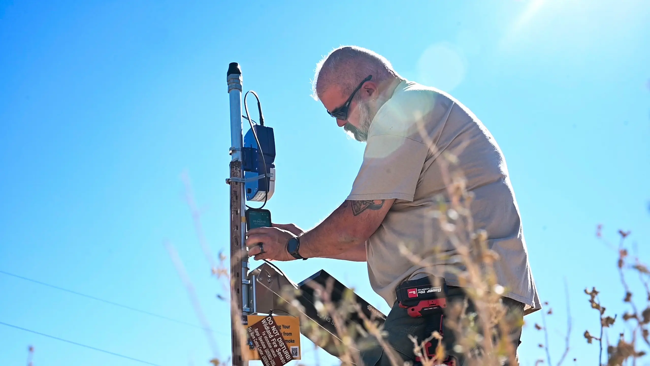
At Kirtland AFB, outside Albuquerque, New Mexico, the Department of Defense (DoD), and the State of New Mexico have partnered to install a network of fire detection sensors as well. The Wildland Urban Interface (WUI) Wildfire Detection Project, as it’s known, has deployed 14 N5SHIELD sensors covering more than 1,000 acres. The units are made by N5 Sensors of Rockville, Maryland.
The sensors are capable of detecting new fire ignitions and discern those starts from background smoke for other wildland fires. They also seek a variety of wildfire signatures such as temperature changes, airborne particulate matter, and ignition byproduct gasses such as carbon monoxide and sulfur oxides. According to a Kirtland AFB spokesperson, “What makes this system unique is the specific combination of advanced sensors, artificial intelligence, and machine learning to detect wildfires in real time, as well as the scale and sensitivity of the system. Current detection systems rely heavily on high-definition cameras, satellites, and drones. This deployment is expected to set a new standard for wildfire detection nationwide.”
The sensor system uses both cellular and long-range radio channels to transmit information to emergency responders who can then dispatch resources to prevent a small fire from growing out of control.
In addition to the sensor package at Kirtland AFB, DoD and the U.S. Forest Service have upgraded the Cibola National Forest and National
Grasslands Air Tanker Base to accommodate Very Large Air Tankers (VLATs). Previously, air tankers operating from the base could only carry
3,000 gallons of retardant, however, improvements to the tanker base now allow for two VLATs to be refilled simultaneously.
Drones. Big Drones
Rotor Technologies of Nashua, New Hampshire, is moving forward with its Robinson R44-based R550X, an unpiloted, heavy lift helicopter. In addition to heavy lift, the R550X has been configured for aerial crop spraying in the company’s “Sprayhawk” version, capable of dispersing 110 gallons (415 liters) of pesticides, and can be adapted to the aerial firefighting and maritime roles. The Sprayhawk was demonstrated in November 2024, at the annual National Agricultural Aviation Association’s Ag Aviation Expo, held in Fort Worth, Texas.
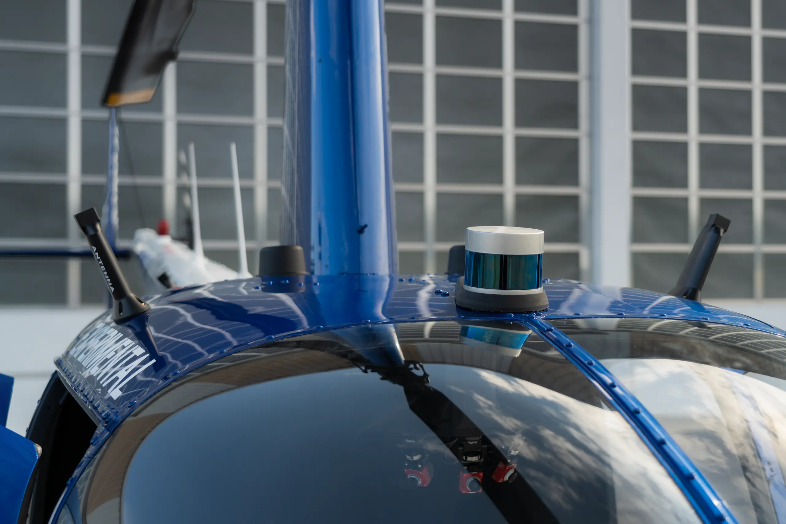
This uncrewed helicopter can lift 1,200 pounds (550 kg) and has a three-hour endurance. The helicopter’s sensor package consists of multiple cameras for viewing by a remote pilot, LIDAR, and electro-optical and IR cameras for operation in reduced visibility. This will enable the R550 to fly 24-hours a day. The R550X’s small size enables it to be trailered from work site to work site and pulled by a large pick-up truck, thereby minimizing relocation costs. Many aerial applicator companies currently fly Robinson R44s, and moving to an uncrewed version could be an economical future step.
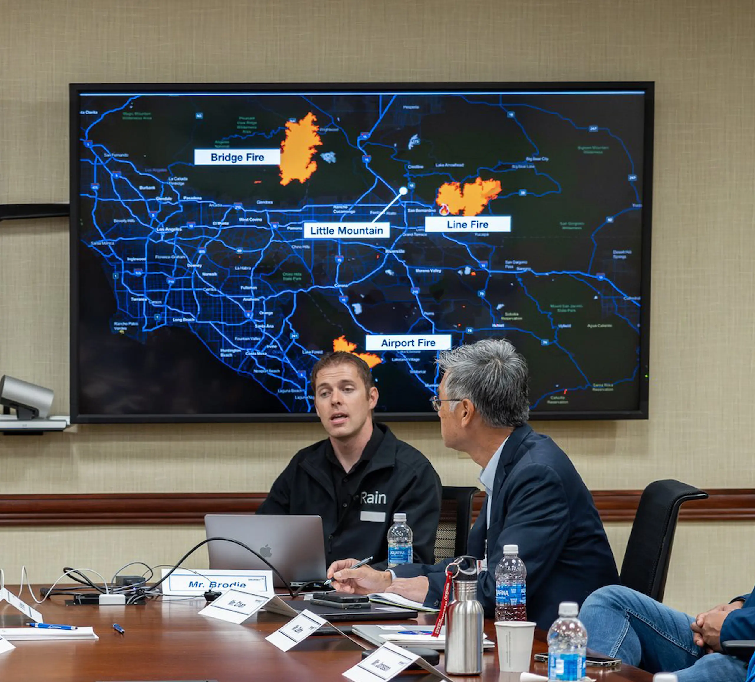
The life-long mission to develop advanced wildland fire suppression technologies began in 2003 in British Columbia, Canada, for friends Maxwell Brodie and Ephraim Nowak. The two grew up near each other and both experienced the 2003 Okanagan Mountain Park wildfire up-close. “I was 11 years old at the time, and this massive fire began with a lightning strike on a single tree. First responders were unable to get to the fire until several hours after sunrise and the winds had picked up. It was too late,” said Brodie, co-founder and CEO of Rain, a software and technology company based in Alameda, California. Bryan Hatton, Rain’s chief technology officer, is the company’s third founding partner.
The Okanangan Mountain Park wildfire was touched off at 4 a.m., on Aug. 16, 2003, fed by extremely dry ground fuels and fierce winds. It soon consumed 239 homes and forced the evacuation of more than 27,000 local residents. In total, the Okanangan Mountain Park wildfire consumed more than 64,000 acres (25,912 hectares), and saw more than 3,000 firefighters, seven Canadair CL-215s, four Lockheed 188 Electras, and one of the Martin Mars flying boats attack the blaze from the sky.
“My background is in software,” said Brodie. “And for much of my life I've been waiting for the right time to build the technologies that would enable a scaling, rapid, initial attack capability that would get suppression resources on incipient fire starts before they become a huge problem.”
To that end, Rain has developed its Wildfire Mission Autonomy software using an uncrewed Composite-FX Mosquito helicopter as a proof-of-concept testbed. The Rain system takes in early wildfire detection information from a variety of sensors, including the ALERTCalifornia network, and then devises an optimal flight path to the suspected ignition’s coordinates. Software on board the aircraft locates the target and develops suppression strategies, which are then selected by the ground operator. Once the human-in-the-loop selects the course of action, the autonomous aircraft sets out to make the drop while incorporating factors like winds aloft and adjusts the flight plan enroute to making the drop.
“We use the Mosquito as a development platform for our software, which we're now very happy to have deployed on much larger aircraft, the
Blackhawk,” Brodie said. The Rain software was recently integrated into the Sikorsky Matrix helicopter fitted with autonomy perception
sensors and the company’s flight software. This Blackhawk, UH-60A serial number 79-23298, N600PV, was fitted with a fly-by-wire kit in early
2019, which enables it to be flown in a pilotless configuration.
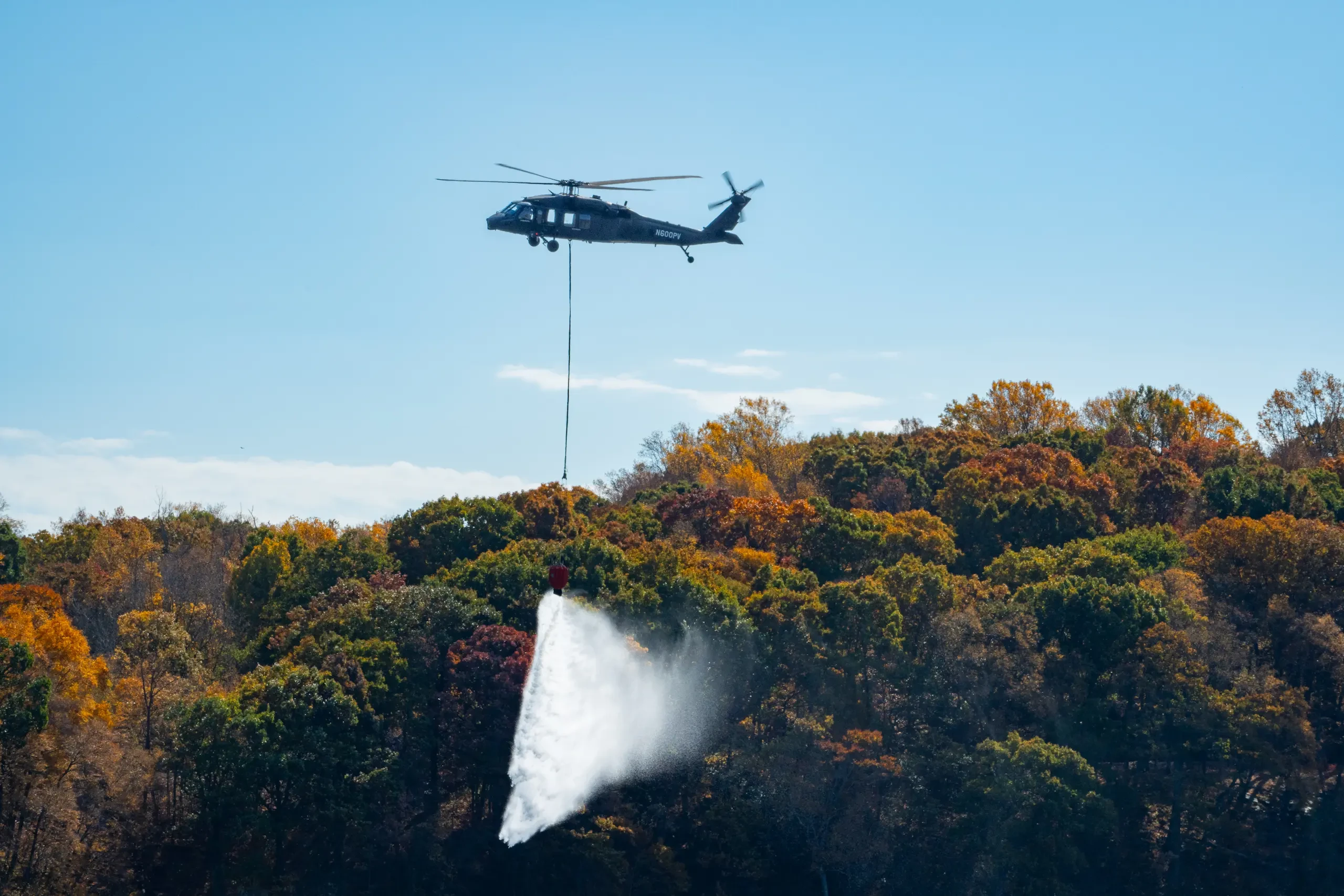
On Oct. 29, 2024, the Blackhawk with both the Matrix flight autonomy system and Rain’s wildfire mission system, flew several demonstrations
at Sikorsky’s Stratford, Connecticut, headquarters. Flew three autonomous flights seeking out a 12-inch ring of fire with flames only three
to six inches tall. Flying in an eight- to 10-knot crosswind with a Bambi bucket slung 60-feet below the rotorcraft, the autonomous
Blackhawk snuffed out the fire on each pass.
The Wildfire Mission Autonomy software supports rotorcraft flying with Bambi buckets or internal and external tanks. For a rapid initial attack mission, it's ideal to have the aircraft preloaded with water on the ground. During air attack operations, there will always be a human-in-the-loop overseeing flight operations, and that operator can direct the helicopter to different water sources to reload and continue making drops. In addition, until such time when large, autonomous aircraft are able to transition through complex airspace, safety pilots will fly the helicopters from base to base. Over time, as trust and confidence in autonomous technology increases within the aviation community, it will be possible to add relocation missions to the software stack.
For Rain, the major focus in 2025 will be transitioning the technology into operational use with fire agencies.
Moving Forward
The use of AI in aerial fire fighting enables greater detection of wildland fire ignition points at the earliest stages. At some point in the near future, AI-driven helicopters will be able to fight fires at all hours of the day and night. The ability to control the airspace used by crewed and uninhabited air- and heli-tankers will enable greater sorties to suppress wildland fires. These are positive aspects of adopting AI in the aerial fire suppression world. However, for the foreseeable future, a human-in-the-loop will continue to be the brains of the operation.